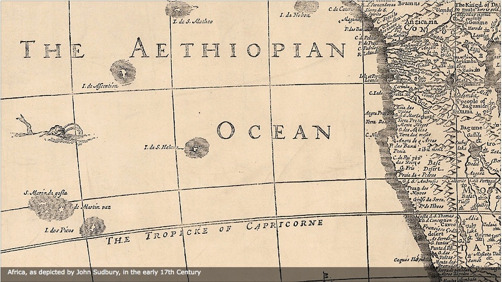
This is brilliant. The BBC, working with the Royal Geographical Society, has posted an audio slideshow showing how the continent’s been depicted on maps from the 14th century onward. A few highlights: we get one theory how the continent got its name from a tribe of Berber who lived in what is now the Sudan, early Jewish presence in North Africa; and that the South Atlantic was known as the Aethopian Sea. We also notice the rich and detailed maps of Africa in the 17th century–drawn with the aid of Africans–as opposed to the deliberately more sparse, color-coded maps of the late 19th and early 20th century that facilitated colonialism. The maps will be exhibited at “Rediscovering African Geographies” at the Royal Geographical Society in London between 22 March – 28 April 2011.

See the audio slideshow on the BBC website.

H/T: Suren Pillay.

Further Reading

Beyond the headlines

Recent violence across the Eritrean diaspora is being instrumentalized by populists. But the violence is a desperate cry for attention and requires the Eritrean opposition to seize the moment for regime change.

Action required

Held in Nairobi this month, the inaugural Africa Climate Summit is an important step for the continent’s response to climate change. Still, the disasters in Libya and Morocco underscore that rhetoric and declarations are not enough.

The strange non-death of Bantustans

That South African political parties across the spectrum were quick to venerate the politician and Zulu prince Mangosutho Buthelezi, who died last week, demonstrates that the country is still attached to Bantustan ideology.

Shifting the guilt

Even though Israeli novelist Agur Schiff’s latest book is meant to be a satirical reflection on the legacy of slavery and stereotypes about Africa, it ends up reinforcing them.

Banana Republics

Western leftists are arguing among themselves about whether there will be bananas under socialism. In Africa, however, bananas do not necessarily represent the vagaries of capitalism.